Using our Ecosystem Map to shape place-based decisions
If you have used our FEA Membership Tools previously, you will know what valuable and powerful tools they are for increasing engagement within and across members, and for targeting your work for the greatest impact.
Our Ecosystem Map shows where FEA members are active and how that lines up with local needs, and over the past six months, we have been putting it to work at a strategic level, helping our place-based collaborations in West Midlands, Liverpool City Region and South Yorkshire. The map has helped the teams within each region decide where to focus and supported us in making the case for your work in conversations with civil servants and policymakers.
In Liverpool City Region, we worked with the FEA’s lead on ward-level analysis that helped identify neighbourhoods for deep, relational pilot work and shaped who was invited to listening events. Local authorities whose areas were not selected still found the insights useful: several told us it helped them see who else was already working nearby, and how they might build on that themselves.
In South Yorkshire, the map supported decisions on living lab neighbourhoods, and surfaced a bigger opportunity: understanding where member engagement is lower, and why. That has grown into a wider strand of work on how the Mayoral Strategic Authority could help broker member capacity more effectively, particularly where schools and charities are stretched thin, work that could shape how support reaches members and the young people they work with.
In the West Midlands, the map has provided insights about the work FEA members are doing in the areas of highest need in the combined authority. The map has been helping build the evidence base for the Partnership Plan, and in the next phase of the project it will help support decisions on neighbourhood selection.
Across all three areas, we have learned the same lesson: the map offers the most value when the analysis is built around a real decision, worked through with the people making it.
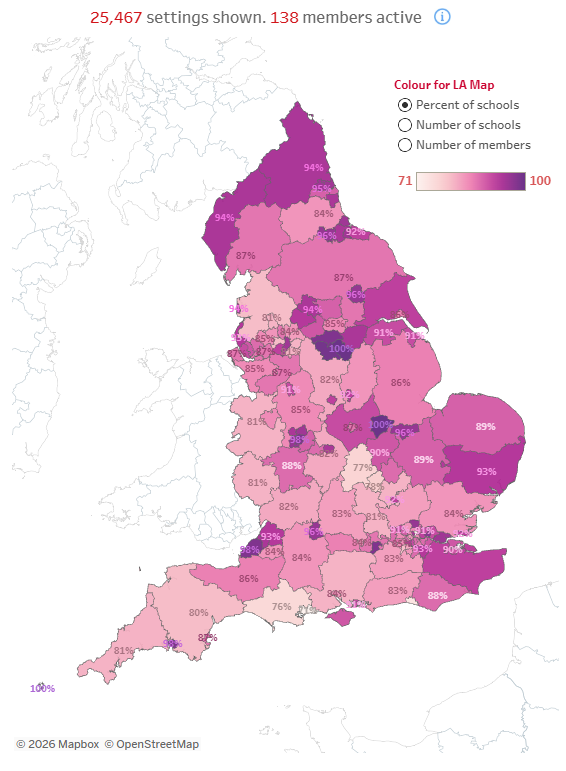
The FEA Ecosystem Map
What are the Ecosystem Map and Member Directory?
Our membership tools include two key elements: the Ecosystem Map and Member Directory. We co-created these with FEA members, to help you connect, collaborate, and better target the children and young people in England who could most benefit from your support. They increase the quality and quantity of member engagement, remove barriers to engagement within and across members, and help you target your work for the greatest impact.
The Ecosystem Map combines public Department for Education data on schools, pupils and outcomes with data on where members are active, with filters for different layers such as local authority, combined authority or MP constituency. That means it can show not just where need is greatest, but where member capacity already exists to meet it, and where it does not – therefore identifying areas of opportunity for members.